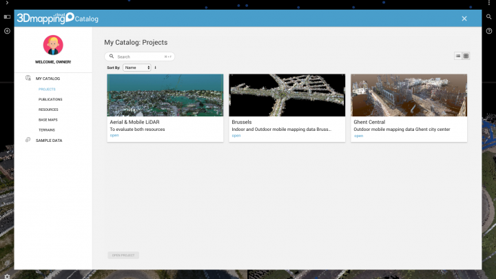
Introducing Projects Sep 11, 2019by Peter Bonnein Data & Resources, ProductivityComments Off on Introducing Projects How will you and your colleagues find what they need in a list of hundreds of datasets ? Of course, you can use the search function, or use tagging to… Read More September 11, 2019
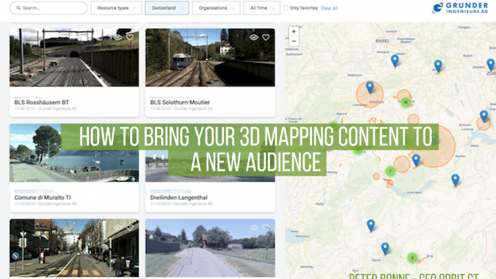
The 3D Mapping Marketplace Sep 3, 2019by Peter Bonnein Account & Subscription, Data & ResourcesComments Off on The 3D Mapping Marketplace So you’ve been collecting streets for a single purpose, e.g. making an inventory of poles. But we all know there’s so much to do with that data. So why not make… Read More September 3, 2019
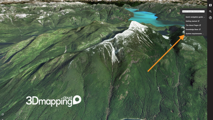
What’s new in 19.7 Aug 7, 2019by Peter Bonnein General, Productivity, Viewer & Sidebars, What's NewComments Off on What’s new in 19.7 The last year, we’ve released an update to 3D Mapping Cloud once a month. The most eye-catching innovations have each been covered on a blog page. But now it’s time… Read More August 7, 2019
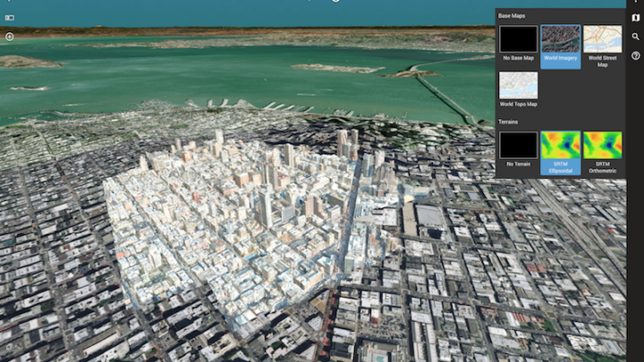
Choose your Base Maps and Terrain Jul 30, 2019by Peter Bonnein Viewer & SidebarsComments Off on Choose your Base Maps and Terrain In the previous blog post, we explained the restructuring of the Right-Hand sidebar. However, there's one more option, that only appears when you have multiple choices available and/or the Reference View... Read More July 30, 2019
The Right-Hand sidebar Jul 24, 2019by Peter Bonnein Viewer & Sidebars, What's NewComments Off on The Right-Hand sidebar Well, not really. It has been around for a few months, but now it's fully into shape. So here you have it. The right-hand sidebar shows generic tools for your... Read More July 24, 2019
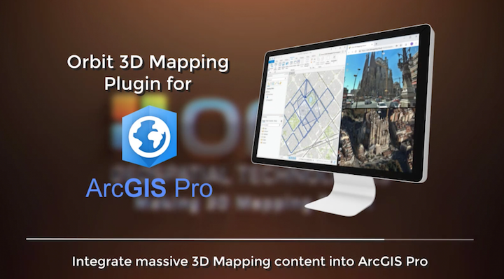
Launching the ArcGIS Pro plugin Jul 10, 2019by Peter Bonnein SDK - Plugins - SharingComments Off on Launching the ArcGIS Pro plugin The 3D Mapping Viewer SDK has come to age and is now implemented for ArcGIS Pro. You can download it here. The plugin is available for free and you can use... Read More July 10, 2019
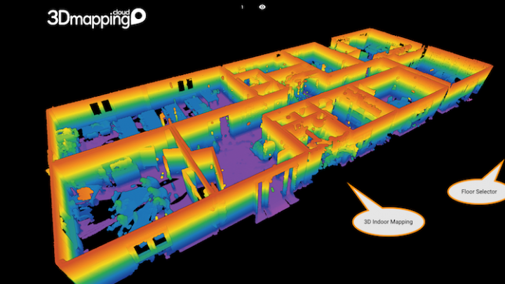
Introducing Floors for Indoor navigation May 21, 2019by Peter Bonnein Data & ResourcesComments Off on Introducing Floors for Indoor navigation When you’re 3D Mapping indoors, your result data will probably cover multiple floors. To visualize these floors, the 3D Mapping Viewer now dynamically adds a Floor navigator to easily switch… Read More May 21, 2019
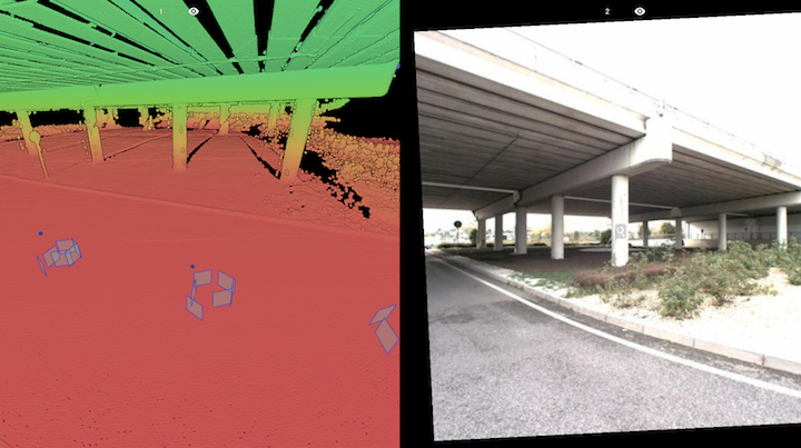
Supporting all Street-level imagery May 14, 2019by Peter Bonnein Data & ResourcesComments Off on Supporting all Street-level imagery Mobile mapping systems typically consist of a scanner and a camera, however, many variations exist. On the camera side, the spherical image is the most popular because of its easy… Read More May 14, 2019
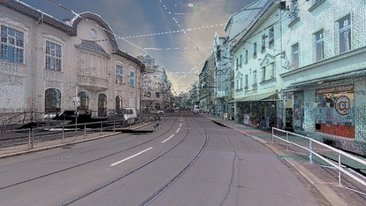
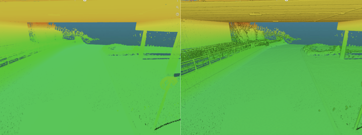
Cool 3D Views with Point Cloud shading May 6, 2019by Peter Bonnein Viewer & SidebarsComments Off on Cool 3D Views with Point Cloud shading Ever considered that LiDAR and point cloud viewing is not so easy to read ? At Orbit GT we’ve introduced a range of tweaking parameters to help you select the best… Read More May 6, 2019
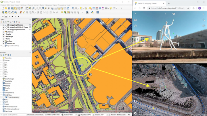
Launching the QGIS Plugin Apr 29, 2019by Peter Bonnein SDK - Plugins - SharingComments Off on Launching the QGIS Plugin Upon popular request, we're pleased to launch the Orbit 3D Mapping Viewer for QGIS plugin. Watch the movie : All features of 3D Mapping Cloud now become instantly available in QGIS :... Read More April 29, 2019
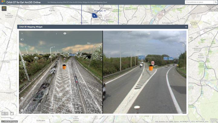
Introducing the ArcOnline Widget Apr 19, 2019by Peter Bonnein SDK - Plugins - SharingComments Off on Introducing the ArcOnline Widget Yes! You can now download the free widget for ArcOnline web apps. Want a quick overview : here's a movie : All features of 3D Mapping Cloud now become... Read More April 19, 2019
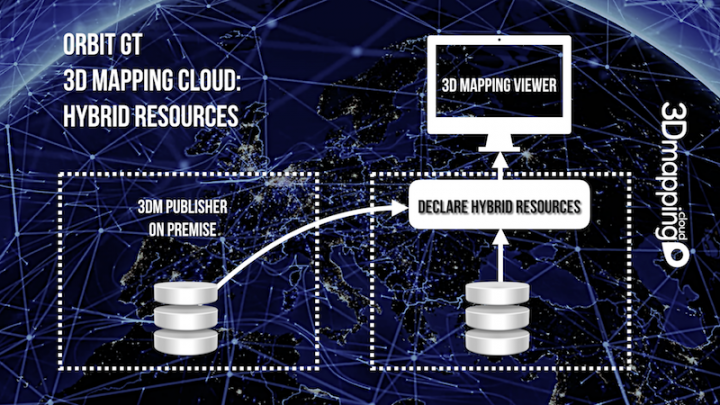
Introducing Hybrid Resources Apr 8, 2019by Peter Bonnein Data & Resources, Publications & BookmarksComments Off on Introducing Hybrid Resources Here’s another great feature : Hybrid Resources. So what are they ? Hybrid Resources are declared in 3D Mapping Cloud but the data is stored in a different environment, e.g. Orbit GT’s… Read More April 8, 2019