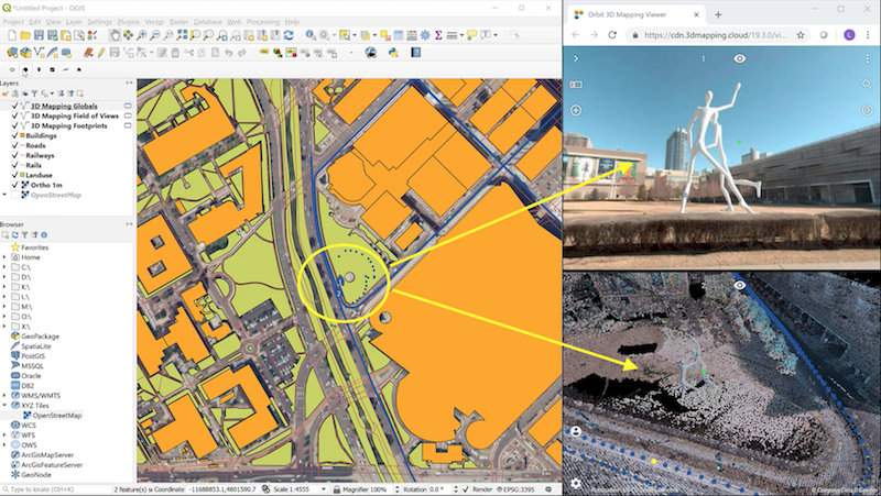
Upon popular request, we’re pleased to launch the Orbit 3D Mapping Viewer for QGIS plugin. Watch the movie :
All features of 3D Mapping Cloud now become instantly available in QGIS :
– fuse complex 3D Mapping data
– unlimited volumes and sizes of point clouds
– blend data together from different 3D content providers
– combine views such as spherical street-level imager and 3D point cloud
– perfect integration in QGIS : view location, content extent, search for content, etc..
– measure in 3D content
– add annotations and 3D Models
– and much, much more…
The plugin is based on the standard 3D Mapping Viewer SDK, using the python API. The implementation is open source: anyone (i.e. any developer) can download and rebuild, or adapt to your needs. Check out the Developer Zone for more information.