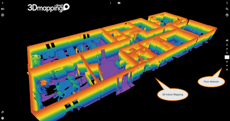
When you’re 3D Mapping indoors, your result data will probably cover multiple floors. To visualize these floors, the 3D Mapping Viewer now dynamically adds a Floor navigator to easily switch between all floors of the project that you have opened.
Indoor Mapping is increasingly executed using Indoor Mapping systems either cart or backpack based. Similar to outdoor systems, LiDAR scanning and imagery is captured in sync. Often, this data is used to derive a floor plan or a modeled version. 3D Mapping Cloud can easily digest all of this sensor data and derivates.
For each resource, you can specify the floor. Then bundle the floors in a Resource Group to unify the data. As soon as you open this bundled Resource in the Viewer, it will detect that it contains data of various floors and will display the floor navigation. All automatic. How cool is that !
Remember you now can fuse outdoor and indoor mapping content in a single view !