The last year, we’ve released an update to 3D Mapping Cloud once a month. The most eye-catching innovations have each been covered on a blog page. But now it’s time to take a look at a huge number of enhancements that have been implemented in that same period.
3D Mapping Cloud – General aspects
- Open Publication by URL:
- Set startup pan and tilt via the publication URL parameters.
- Set startup coordinate, improved for usage within SDK
3D Mapping Cloud Viewer
- Viewer Catalog:
- Display thumbnail for resources and publications.
- Viewer Settings:
- The available measure techniques is a dynamic list, only the relevant measure techniques are listed.
- Specify “3D Measurement” measure technique
- Viewer UI:
- Floors: Enter a random floor number/name to go to the specific floor.
- Reworked Top-right Viewer Menu
- Reference View:
- Improved quality of rendering large and very-high-resolution orthophoto base maps.
- Implementation of Resize Reference View
- All Views:
- To move all views of your Viewer at once, hold Shift while in move mode and choose a new location. While holding Shift, ‘move’ in the View action Fly-out will change to ‘move all’ to indicate this
- All Image Views:
- Metadata overlay of image recording timestamp, popup window showing resource name, description, copyright, floor, collection date and image id, coordinates, resolution, timestamp.
- New view mode and complete integration of mobile mapping planar images.
- Open Image by Recording Position. Change the 3D View to a specific Spherical or Planar Image View.
- 3D View:
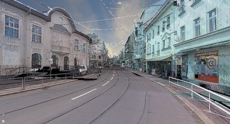
- Added Eyedome Lighting. It’s now possible to render a point cloud using Eyedome or Shaded Lighting.
- Spherical View:
- Improved rendering by low-performance GPU emulators, e.g. Google Swiftshader, used if no hardware acceleration is available.
- Added ‘view by recording position’ opens the spherical image in driving direction
- Play Function: The play function in an image view was improved and can now be used when several image views are opened.
- Oblique View:
- Improved determination technique to open the best candidate oblique image focusing a requested coordinate.
- Various improvements for handling Oblique resources have been implemented, e.g zoom to the cursor position, display of the field of view and resource footprints, restoring oblique workspace, and more, adding to the overall user experience.
- Set resource visibility by floor and navigate easily between multiple floors. (Cloud only)
- Resource sidebar: reworked the Resource edit options into a context menu, and added access to Resource Specs, subject to user roles.
- Inspector sidebar: Refine search result by querying multiple attributes.
- Annotations sidebar: Add System 3D Model Library
There is a list of System 3D Models available to every User next to the companies 3D Model Library.
3D Mapping Viewer SDK and Plugins
- Viewer SDK:
- New ViewerActions and doAction method to set measurement function, measure technique, and to trigger start, stop and clear measurement.
- Signal onWorkspaceOpened and onWorkspaceClosed added to indicate a workspace and all its resources are ready to use.
- Set startup focus coordinate, pan, and tilt via startup login options.
- Diamond, square, star and triangle are added as point symbol styling of map objects.
- API method to set the measurement technique and activate any measure function.
- Launch of a QGIS plugin
- Added overlay for a QGIS-layer to the 3D Mapping Viewer regardless of the type of symbology (simple, categorized, graduated or rule-based) used in QGIS.
- The 3D Mapping Viewer plugin for QIS enables connection and interaction with the 3D Mapping Viewer for Cloud and Publisher. Measurements made in the 3D Mapping Viewer are visualized in QGIS and can be saved to a QGIS layer. QGIS layers can be overlaid to 3D Mapping Viewer, using the formatting of the layer in QGIS.
- Launch of an ArcGIS Pro plugin.
- Launch of an ArcOnline widget.
3D Mapping Cloud Console
-
Publications: Additional publication setup parameters (sidebars, view modes, and settings) to create simplified publications.
-
Resources and Publications: Upload thumbnails for resources, resources groups, and publications.
-
Resources: Specs & Tags (Basic and Properties) of shared resources are viewable for 3rd party named users.
-
Resources: Redesigned UI and layout, Mobile friendly responsive design for Resources Specs & Tags.
-
3D Models: Redesigned UI and layout of 3D Models Specs & Categories.
-
Manage floors for mobile mapping resources.
-
Take Resource Ownership for select user roles
-
Display of current amount of active Guest Users
-
Introduction of Hybrid resources: Declare 3DM Publisher resources in 3D Mapping Cloud console to jointly consult private and cloud-based resources.
-
Introduction of Categories for 3D Models
-
Set Prefered Coordinate System
-
Guest User Uses for Publications: An extra column in the list of your publications indicates how many guest users are assigned to each publication. On the top right of that page, the total amount of guest users can also be consulted.
-
Duplicate Publication
-
Area restricted Tiled Mapping Service: 3D Mapping Cloud now supports auxiliary files which makes it possible to add and view Tiled Map Service that covers a limited area only.
-
Enhancements and usabilities
-
Improved display of resource and resource groups specs and tags.
-
Clear guest user for publications.
-
Ability to change the company’s primary data store for Account Administrator and Account Owner roles.
-
Access to Invoices page for Subscription Manager and Billing Agent roles.
-
The Sharing of Resource Groups via a Publication to Guest Users is now better managed.
-
August 7, 2019