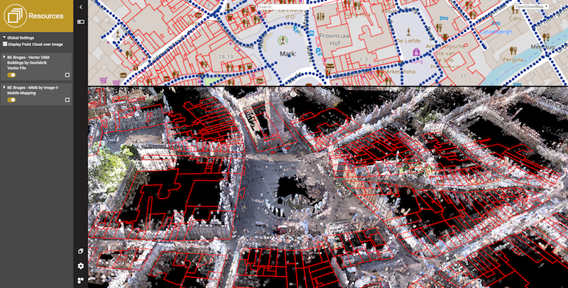
Yes we support vector data : points, lines, area’s. Similar to your 3D mapping data, you can upload this type of data and it simply appears as another resource in your catalog.
To view a vector dataset, just select it like any other resource. Vector data is displayed on top of the 3D scene, so that you can see what lies ‘underneath’ or behind a building in a single view. During you pan, zoom or rotate, vector data is temporarily hidden to speed up viewing performance. As soon as you let go, it is shown again.
To upload vector data, use one of the upload tools (see About Upload Tools ). It is advised to prepare vector data as ‘OVT’ files – that’s the Orbit way to manage large datasets and yet be able to stream them easily. Streaming of vector data starts when you’re zoomed in close enough. That’s to avoid download of too much data, again to boost performance.
In later versions, we’ll come back on this adding more tweaking options. But for now, it’s just great that this is available, just in the way you can do on all of our desktop products.