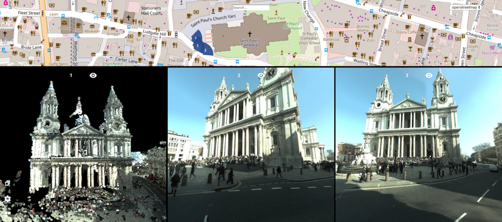
Reference Map, what’s that ? Well, in general that’s the traditional 2D map you use to know where you’re at. It can show any type of basemap, like a street map or an orthophoto, and it displays where you other view’s are located. The other views of course are 3D views like a point cloud, a spherical street level image, a UAV nadir image, an oblique image and so on.
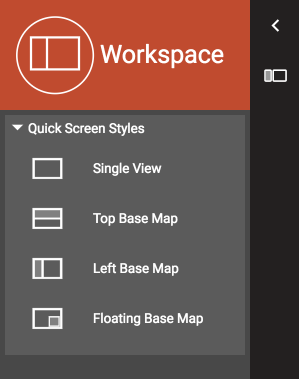
A Reference Map is a part of a Screen Layout that combines this Reference Map with one or more 3D views. Here’s the list of Screen Layouts you can pick from. The ‘Single View’ does not have a Reference Map. The Reference Map is shown slightly grey in the icons, positioned on top, left or floating. The other part of the Screen Layout is for the 3D view(s) of which you can add up to 3 instances.
To navigate, just drag to pan and scroll to zoom.
The Reference Map will also follow your 3D views. If you wander outside of the area you’re viewing, it will pan and centralize the position of the 3D view on the Reference Map.
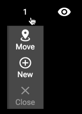
In the 3D view, you can use the Move menu option to reposition your viewpoint. Click on the menu option and then click on the Reference Map. Your 3D view will adjust automatically, no matter if you’re viewing a point cloud or any image (image shown will be the one nearest to the desired position). In point cloud view, you will smoothly fly to the new position. Pretty cool !
Note : To pick a basemap, select one from the top right choice box. This box lists all Resources that have been defined as Basemap in your catalog and to which you have permissions to use.
And finally : the Reference Map also shows a search field. Type in any address – you know how that works ins’t it !