No 3D Mapping solution is complete if it doesn’t support traditional GIS/CAD vector data. So, we do.
And we’ve done it for a while, but now we’ve added quite some power to this side of 3D Mapping.
In Orbit GT’s desktop products, support for huge volumes of vector data has been available since day one (and that’s ages ago). This power has now been ported to 3D Mapping Cloud, including the most important graphic settings such as line width, colour, filling and so on.
3D Mapping Cloud supports 3D as well as old fashioned 2D vector data. This data appears simply in your Resources list right at the same level as complex 3D data such as UAV Mapping or street level Mobile Mapping. The Resources sidebar gives access to the Legend editor.
A great tip is to prepare your vector data using Orbit GT’s 3DM Content Manager : legend settings are uploaded together with the data so you’re good to go in one simple step.
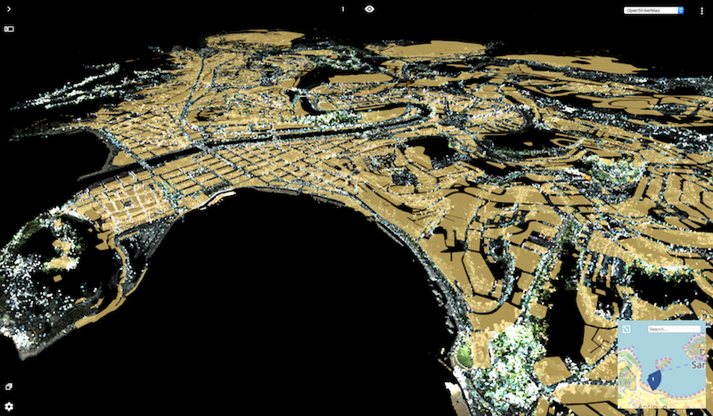
In this image : the city of Donostia / San Sebastian in northern Spain, showing city wide coverage by Mobile Mapping (282.32 Gb) and building footprints in vector data (5.02 Mb) streaming right to your desktop.