Here’s a bullet list of all updates to 3dmapping.cloud made available today
- Enhancements on measurements
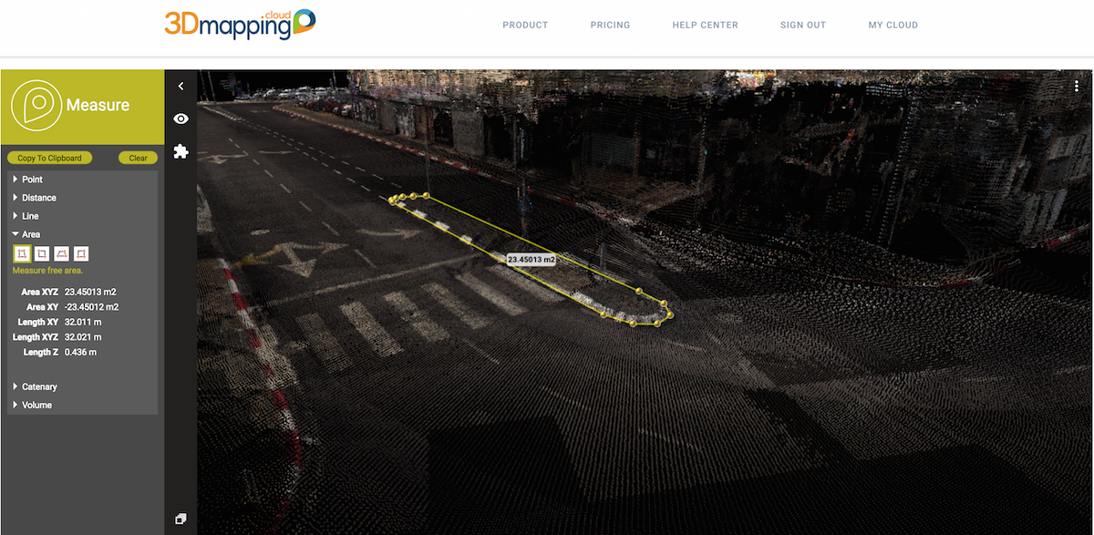
New measurements for points, lines, Areas, distances and catenaries
Insert, Delete and Move measured vertices
Copy measurement results to clipboard
Highlight current measurement function
Display tooltip and label for all measurement functions
Updated presentation of measure results - Enhancements on 3D Point Cloud Viewing
Updated color ramp of point cloud display by height and intensity
Optimised presentation of point cloud data having a projected crs
Faster response time on point cloud streaming - Enhancements on Spherical Image Viewing
Improved presentation of point cloud data at ground height
Display photo recording locations based on mouse cursor position - Subscribe to a Plan
Upgrade from Trial account to a subscription Plan and Storage
Select a Plan and Storage upon registration
Invite co-workers within your plan - Upload data
Upload your own Mobile Mapping resources
Support for ‘spherical images only’ resources - View your data
Separate view of trial data and your own data in the Catalog list
Resources using the same crs can be viewed simultaneously. - Release of Upload capability in Orbit MM Content Manager v17.1
For Mobile Mapping resources (planar images not yet supported in 3dmapping.cloud viewer)
For GIS resources line, area, and basemap data (e.g. orthophoto)
May 17, 2017