Got UAS/UAV/Drone data ? Now bring it online and share instantly.
The latest version or UAS Mapping (that’s version 17.1.1) is now available from www.orbitgt.com. Data from drones can be imported and uploaded. Data processed by Pix4D or AgiSoft can use an optimized workflow (see Orbit GT Knowledge Base).
If you own a license of this product, get the update right away. You are entitled for a free update if you’re still within the maintenance plan.
Sharing drone data has never been easier. Do read the blogs and pages on how to Upload and how to Share data.
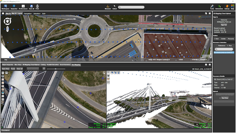
The Viewer has been extended to dynamically adapt itself to the availability of drone data. Typically, this data contains a point cloud and aerial imagery. The point cloud is either from a LiDAR system or dense matched using the imagery. The imagery is usually overlapping. In any case, the viewer knows this and adds a viewing option to view 1 image at the time, optionally overlaying the point cloud. You can combine a UAS dataset with any other dataset you have uploaded – it’s dynamically managed. You can check it out using the trial data, where you can combine aerial LiDAR, Mobile Mapping and UAS mapping data from the same region.